Geolocalizar

Mapa topográfico Eesergroen

Mapa interactivo

Haga clic en el mapa para ver la altitud.

Acerca de este mapa

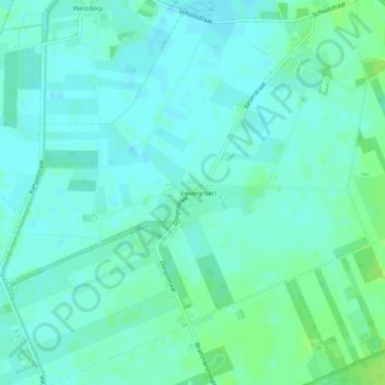
Nombre: Mapa topográfico Eesergroen, altitud, relieve.

Lugar: Eesergroen, Borger-Odoorn, Drenthe, Pays-Bas (52.87506 6.75605 52.90495 6.80310)

Altitud media: 16 m

Altitud mínima: 12 m

Altitud máxima: 24 m

Otros mapas topográficos

Haga clic en un mapa para ver su topografía, su altitud y su relieve.

Spier

Pays-Bas > Drenthe

Spier, Midden-Drenthe, Drenthe, Pays-Bas

Altitud media: 14 m

Bronneger

Pays-Bas > Drenthe > Bronneger

Bronneger, Borger-Odoorn, Drenthe, Pays-Bas, 9527 TC, Pays-Bas

Altitud media: 15 m

Pesse

Pays-Bas > Drenthe > Pesse

Pesse, Hoogeveen, Drenthe, Pays-Bas

Altitud media: 13 m

Emmen

Pays-Bas > Drenthe

Emmen, Drenthe, Pays-Bas

Altitud media: 16 m

Assen

Pays-Bas > Drenthe

Assen, Drenthe, Pays-Bas

Altitud media: 13 m

De Tippe

Pays-Bas > Drenthe > Drogteropslagen > De Tippe

De Tippe, Drogteropslagen, De Wolden, Drenthe, Pays-Bas, 7701RW, Pays-Bas

Altitud media: 8 m

Aa en Hunze

Pays-Bas > Drenthe > Aa en Hunze

Aa en Hunze, Drenthe, Pays-Bas

Altitud media: 12 m

Wezuperbrug

Pays-Bas > Drenthe > Coevorden

Wezuperbrug, Coevorden, Drenthe, Pays-Bas

Altitud media: 20 m

Yde

Pays-Bas > Drenthe > Tynaarlo

Yde, Tynaarlo, Drenthe, Pays-Bas

Altitud media: 5 m

Westerveld

Pays-Bas > Drenthe

Westerveld, Drenthe, Pays-Bas

Altitud media: 8 m

Borger-Odoorn

Pays-Bas > Drenthe

Borger-Odoorn, Drenthe, Pays-Bas

Altitud media: 14 m

Hoogeveen

Pays-Bas > Drenthe

Hoogeveen, Drenthe, Pays-Bas

Altitud media: 12 m

Coevorden

Pays-Bas > Drenthe > Coevorden

Coevorden, Drenthe, Pays-Bas

Altitud media: 11 m

Elim

Pays-Bas > Drenthe > Hoogeveen

Elim, Hoogeveen, Drenthe, Pays-Bas

Altitud media: 12 m

Wateren

Pays-Bas > Drenthe

Wateren, Westerveld, Drenthe, Pays-Bas

Altitud media: 10 m