
Gracias por apoyar a este sitio ❤️
Haz una donación
Haz una donación
Mapa topográfico Sackertown
Haga clic en el mapa para ver la altitud.
Gracias por apoyar a este sitio ❤️
Haz una donación
Haz una donación
Acerca de este mapa
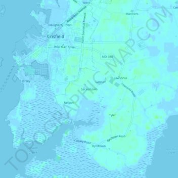
Nombre: Mapa topográfico Sackertown, altitud, relieve.
Lugar: Sackertown, Somerset County, Maryland, 21817, United States (37.95235 -75.86271 37.99235 -75.82271)
Altitud media: 1 m
Altitud mínima: -4 m
Altitud máxima: 6 m
Gracias por apoyar a este sitio ❤️
Haz una donación
Haz una donación
Otros mapas topográficos
Haga clic en un mapa para ver su topografía, su altitud y su relieve.
Crisfield
United States > Maryland > Somerset County
Crisfield is a very compact city, with little vacant land. According to the United States Census Bureau, the city has a total area of 3.06 square miles (7.93 km2), of which 1.62 square miles (4.20 km2) (53.0%) is land and 1.44 square miles (3.73 km2) (47.0%) is water. As one of the southern points on the…
Altitud media: 1 m
Gracias por apoyar a este sitio ❤️
Haz una donación
Haz una donación