
Haz una donación
Mapa topográfico Turlock
Haga clic en el mapa para ver la altitud.
Haz una donación
Turlock
Turlock lies in Stanislaus County, at 37°30′21″N 120°50′56″W / 37.50583°N 120.84889°W / 37.50583; -120.84889 (37.505725, −120.849019), between the cities of Modesto and Merced, at the intersection of State Route 99 and State Route 165. Its elevation is about 31 m (101 ft) above MSL. According to the United States Census Bureau, the town has a total area of 16.9 square miles (44 km2), all of it land.
Haz una donación
Acerca de este mapa
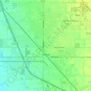
Nombre: Mapa topográfico Turlock, altitud, relieve.
Lugar: Turlock, Stanislaus County, California, United States (37.46609 -120.90367 37.53753 -120.81210)
Altitud media: 34 m
Altitud mínima: 26 m
Altitud máxima: 41 m
Haz una donación
Otros mapas topográficos
Haga clic en un mapa para ver su topografía, su altitud y su relieve.
Oakdale
United States > California > Stanislaus County > Oakdale
Historically the area has been used for orchards and other agricultural uses. Some of the common soil types found in Oakdale are Delhi sand, Oakdale sandy loam, Hanford sandy loam, and Tujunga loamy sand. Oakdale is generally on level ground at an elevation of approximately 190 feet (58 m) above mean sea…
Altitud media: 66 m