
Mapa topográfico Kinabalu Park
Mapa interactivo
Haga clic en el mapa para ver la altitud.
Acerca de este mapa
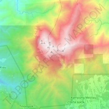
Nombre: Mapa topográfico Kinabalu Park, altitud, relieve.
Altitud media: 2.063 m
Altitud mínima: 673 m
Altitud máxima: 4.062 m
The park headquarters is 88 kilometres away from the city of Kota Kinabalu. There are sealed roads leading towards the park headquarters from other parts of Sabah. It is situated on the southern boundary of Kinabalu Park, at an elevation of 1,563 m (5,128 ft).