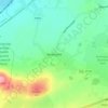
Mapa topográfico County Kilkenny
Haga clic en el mapa para ver la altitud.
County Kilkenny
The River Nore flows through the county and the River Suir forms the border with County Waterford. Brandon Hill is the highest point with an elevation of 515 m (1,690 ft). Most of the county has a hilly surface of moderate elevation with uplands in the north-east, the north-west and the South of the county; the middle is lower by comparison.
Acerca de este mapa

Nombre: Mapa topográfico County Kilkenny, altitud, relieve.
Lugar: County Kilkenny, Leinster, Ireland (52.24287 -7.67400 52.89394 -6.91456)
Altitud media: 120 m
Altitud mínima: -4 m
Altitud máxima: 784 m
Otros mapas topográficos
Haga clic en un mapa para ver su topografía, su altitud y su relieve.
Greystones
Greystones is located south of the site of an ancient castle of the Barony of Rathdown. There was a hamlet which, like Rathdown Castle, was known as Rathdown, and which appeared on a 1712 map. This site occupied an area now known as the Grove, north of Greystones harbour, but only the ruins of a chapel, St.…
Altitud media: 49 m









Carrauntoohil
Carrauntoohil is the highest mountain in Ireland on all classification scales. It is the 133rd-highest mountain, and 4th most prominent mountain, in Britain and Ireland, on the Simms classification. Carrauntoohil is regarded by the Scottish Mountaineering Club (SMC) as one of 34 Furths, which are defined as…
Altitud media: 644 m


Limerick
Ireland > County Limerick > Limerick
Limerick's climate is classified as temperate oceanic (Köppen Cfb). Met Éireann maintains a climatological weather station at Shannon Airport, 20 kilometres west of the city in County Clare. Shannon Airport records an average of 977 millimetres of precipitation annually, most of which is rain. Limerick has a…
Altitud media: 10 m