Mapa topográfico Kimpflen
Haga clic en el mapa para ver la altitud.
Acerca de este mapa
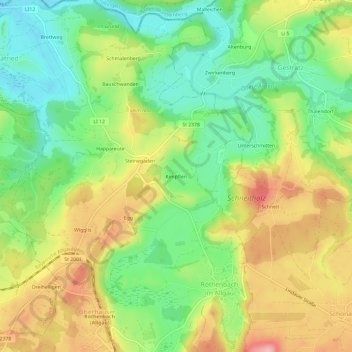
Nombre: Mapa topográfico Kimpflen, altitud, relieve.
Altitud media: 666 m
Altitud mínima: 596 m
Altitud máxima: 757 m

Haga clic en el mapa para ver la altitud.
Nombre: Mapa topográfico Kimpflen, altitud, relieve.
Altitud media: 666 m
Altitud mínima: 596 m
Altitud máxima: 757 m