

Mapas topográficos Michigan
Haga clic en un mapa para ver su topografía, su altitud y su relieve.


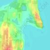
Old Mission
United States > Michigan > Grand Traverse County
Old Mission is located just east of M-37 near the tip of Old Mission Peninsula about 16 miles (25.75 km) north of Traverse City. The community was built along Old Mission Harbor, which is a small safe haven along the East Arm of Grand Traverse Bay. The community sits at an elevation of 587 feet (179 m) above…
Altitud media: 190 m


Eastmanville Bayou
United States > Michigan > Ottawa County > Allendale Charter Township
Altitud media: 188 m


Burchfield Park
United States > Michigan > Ingham County > Delhi Charter Township
Altitud media: 268 m


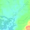
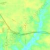


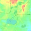







Felch Mountain
United States > Michigan > Dickinson County > Felch Township > Felch
Altitud media: 354 m





Hulbert
United States > Michigan > Chippewa County > Hulbert Township
Hulbert is a rural community in western Chippewa County in the Upper Peninsula. The community is located within Hulbert Township about 40 miles (64 km) south of the Tahquamenon Falls. The community sits at an elevation of 751 feet (229 m) above sea level.
Altitud media: 231 m





Cambridge Junction
United States > Michigan > Lenawee County > Cambridge Township
Altitud media: 305 m



Green Oak
United States > Michigan > Livingston County > Green Oak Charter Township
Altitud media: 275 m


Anchor Bay Shores
United States > Michigan > Macomb County > Chesterfield Township
Altitud media: 176 m


Barton City
United States > Michigan > Alcona County > Hawes Township
Barton City is at 44°41′03″N 83°36′20″W / 44.68417°N 83.60556°W / 44.68417; -83.60556 (Barton City, Michigan) with an elevation of 830 feet (250 m) above sea level.
Altitud media: 258 m

