
Mapa topográfico 大吉山镇
Mapa interactivo
Haga clic en el mapa para ver la altitud.
Acerca de este mapa
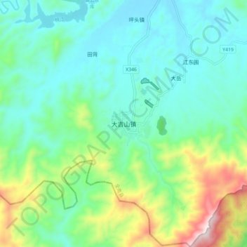
Nombre: Mapa topográfico 大吉山镇, altitud, relieve.
Lugar: 大吉山镇, 全南县, 赣州市, 江西省, 中国 (24.56526 114.32270 24.64526 114.40270)
Altitud media: 500 m
Altitud mínima: 333 m
Altitud máxima: 999 m
Otros mapas topográficos
Haga clic en un mapa para ver su topografía, su altitud y su relieve.