
Haz una donación
Mapa topográfico Redwoods
Haga clic en el mapa para ver la altitud.
Haz una donación
Acerca de este mapa
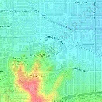
Nombre: Mapa topográfico Redwoods, altitud, relieve.
Altitud media: 249 m
Altitud mínima: 229 m
Altitud máxima: 314 m
Haz una donación
Otros mapas topográficos
Haga clic en un mapa para ver su topografía, su altitud y su relieve.
West Hills Neighborhood Council District
United States > California > Los Angeles County > Los Angeles
Altitud media: 319 m
Los Angeles City Council District 7
United States > California > Los Angeles County > Los Angeles
Altitud media: 512 m
Haz una donación
Los Angeles City Council District 5
United States > California > Los Angeles County > Los Angeles
Altitud media: 131 m
Santa Ynez Reservoir
United States > California > Los Angeles County > Los Angeles
Altitud media: 307 m
Pacific Palisades
United States > California > Los Angeles County > Los Angeles
Pacific Palisades was formally founded in 1921 by a Methodist organization, and in the years that followed became a refuge for Jewish artists and intellectuals fleeing the Holocaust. The Palisades would later be sought after by celebrities and other high-profile individuals seeking privacy. It is known for its…
Altitud media: 196 m
Haz una donación
Haz una donación
Los Angeles City Council District 6
United States > California > Los Angeles County > Los Angeles
Altitud media: 252 m
Haz una donación
Arleta Neighborhood Council District
United States > California > Los Angeles County > Los Angeles
Altitud media: 274 m
Augustus F. Hawkins Natural Park
United States > California > Los Angeles County > Los Angeles
Altitud media: 55 m
Haz una donación