
Haz una donación
Mapa topográfico Brunswick Nature Park
Haga clic en el mapa para ver la altitud.
Haz una donación
Acerca de este mapa
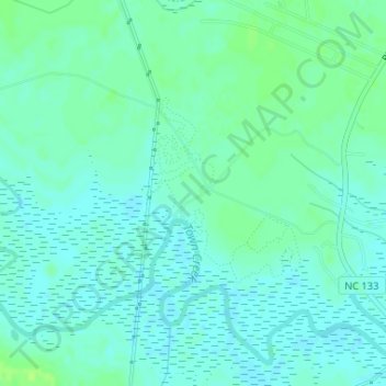
Nombre: Mapa topográfico Brunswick Nature Park, altitud, relieve.
Altitud media: 5 m
Altitud mínima: 0 m
Altitud máxima: 11 m
Haz una donación
Otros mapas topográficos
Haga clic en un mapa para ver su topografía, su altitud y su relieve.
Ocean Isle Beach
United States > North Carolina > Brunswick County
Ocean Isle Beach is a picturesque barrier island characterized by its low-lying terrain and sandy shorelines. The topography features an average elevation of about 3 feet (1 meter) above sea level, with the landscape gently sloping towards the Atlantic Ocean. The island spans approximately 7 miles in length…
Altitud media: 4 m
Haz una donación
Haz una donación
Haz una donación
Boiling Spring Lake Dam
United States > North Carolina > Brunswick County > Boiling Spring Lakes
Altitud media: 14 m
Haz una donación
Bald Head Island
United States > North Carolina > Brunswick County
Located at the tip of Cape Fear and residing at the convergence of the Cape Fear River and Atlantic Gulf Stream, the land mass of Bald Head Island ends, trailing off into 30 miles (48 km) of treacherous sand bars known as Frying Pan Shoals. In this area, large sand bars seasonally emerge from and subsequently…
Altitud media: 0 m
Haz una donación
Caswell Beach
United States > North Carolina > Brunswick County
Roughly halfway distant from Wilmington, North Carolina and Myrtle Beach, South Carolina, Caswell Beach is located on the east end of Oak Island. This island is the easternmost of the South Brunswick Islands which were formed in the late 1930s by the construction of the Intracoastal Waterway (ICW) which was…
Altitud media: 1 m
Bald Head Island
United States > North Carolina > Brunswick County > Bald Head Island
Altitud media: 3 m
Bald Head Island
United States > North Carolina > Brunswick County
Located at the tip of Cape Fear and residing at the convergence of the Cape Fear River and Atlantic Gulf Stream, the land mass of Bald Head Island ends, trailing off into 30 miles (48 km) of treacherous sand bars known as Frying Pan Shoals. In this area, large sand bars seasonally emerge from and subsequently…
Altitud media: 0 m
Haz una donación
Haz una donación
Haz una donación