
Haz una donación
Mapa topográfico Bluffdale
Haga clic en el mapa para ver la altitud.
Haz una donación
Bluffdale
Bluffdale has an area of 10.22 square miles (26.47 km2) and an average elevation of 4,436 feet (1,352 m) above sea level. Bluffdale is predominately located in Salt Lake County, though a portion of the city is in Utah County. Bluffdale shares city borders with Herriman to the west, Riverton to the north, Draper to the east, and Lehi to the south.
Haz una donación
Acerca de este mapa
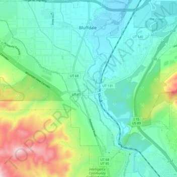
Nombre: Mapa topográfico Bluffdale, altitud, relieve.
Lugar: Bluffdale, Salt Lake County, Utah, United States (40.42969 -111.99167 40.50082 -111.89886)
Altitud media: 1.468 m
Altitud mínima: 1.328 m
Altitud máxima: 1.894 m
Haz una donación
Otros mapas topográficos
Haga clic en un mapa para ver su topografía, su altitud y su relieve.
Salt Lake City
United States > Utah > Salt Lake County > Salt Lake City
Salt Lake City has an area of 110.4 square miles (286 km2) and an average elevation of 4,327 feet (1,319 m) above sea level. The lowest point within the boundaries of the city is 4,210 feet (1,280 m) near the Jordan River and the Great Salt Lake, and the highest is Grandview Peak, at 9,410 feet (2,868 m).
Altitud media: 1.625 m
Haz una donación
Brighton
United States > Utah > Salt Lake County
Brighton has a high-altitude cold continental climate (Köppen Dsb/Dsc), with dry summers and very snowy winters.
Altitud media: 2.852 m
Haz una donación