
Haz una donación
Mapa topográfico Schnecksville
Haga clic en el mapa para ver la altitud.
Haz una donación
Schnecksville
According to the U.S. Census Bureau, Schnecksville has a total area of 2.7 square miles (7.0 km2), of which 0.01 square miles (0.02 km2), or 0.28%, are water. Schnecksville sits on a ridge at an elevation of about 660 feet (200 m) above sea level. To the west, water flows to Jordan Creek, while to the east water flows to Coplay Creek. Both creeks are southeast-flowing tributaries of the Lehigh River and part of the Delaware River watershed.
Haz una donación
Acerca de este mapa
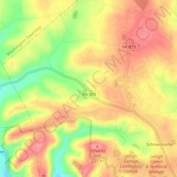
Nombre: Mapa topográfico Schnecksville, altitud, relieve.
Altitud media: 197 m
Altitud mínima: 144 m
Altitud máxima: 229 m
Haz una donación
Otros mapas topográficos
Haga clic en un mapa para ver su topografía, su altitud y su relieve.
Kernsville
United States > Pennsylvania > Lehigh County > North Whitehall Township
Altitud media: 147 m
Haz una donación