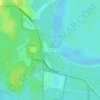
Mapa topográfico Jonesville
Haga clic en el mapa para ver la altitud.
Acerca de este mapa

Nombre: Mapa topográfico Jonesville, altitud, relieve.
Lugar: Jonesville, Alachua County, Florida, 32669, United States (29.63442 -82.54303 29.67442 -82.50303)
Altitud media: 30 m
Altitud mínima: 23 m
Altitud máxima: 37 m
Otros mapas topográficos
Haga clic en un mapa para ver su topografía, su altitud y su relieve.

Gainesville
United States > Florida > Alachua County
Gainesville is situated in a region characterized by gently rolling hills and a mix of flatlands, typical of north-central Florida's terrain. The elevation ranges from approximately 50 to 200 feet above sea level, providing a scenic landscape dotted with lush vegetation and various waterways, including the…
Altitud media: 42 m


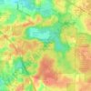
San Felasco Hammock Preserve State Park
United States > Florida > Alachua County > Alachua
Altitud media: 45 m