
Mapa topográfico Gun Lake
Mapa interactivo
Haga clic en el mapa para ver la altitud.
Acerca de este mapa
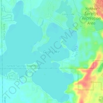
Nombre: Mapa topográfico Gun Lake, altitud, relieve.
Altitud media: 234 m
Altitud mínima: 222 m
Altitud máxima: 285 m
Otros mapas topográficos
Haga clic en un mapa para ver su topografía, su altitud y su relieve.
Hastings Township
United States > Michigan > Barry County
Hastings Township, Barry County, Michigan, United States
Altitud media: 265 m
Hastings
United States > Michigan > Barry County
Hastings, Barry County, Michigan, 49058, United States
Altitud media: 252 m
Thornapple River
United States > Michigan > Barry County > Irving
Thornapple River, Irving, Irving Township, Barry County, Michigan, United States
Altitud media: 236 m