
Mapa topográfico Tokyo
Mapa interactivo
Haga clic en el mapa para ver la altitud.
Acerca de este mapa
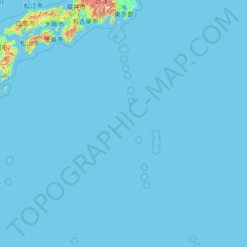
Nombre: Mapa topográfico Tokyo, altitud, relieve.
Lugar: Tokyo, Japan (20.21458 135.85369 35.89842 154.20554)
Altitud media: 22 m
Altitud mínima: -3 m
Altitud máxima: 3.459 m
The mainland portion of Tokyo lies northwest of Tokyo Bay and measures about 90 km (56 mi) east to west and 25 km (16 mi) north to south. The average elevation in Tokyo is 40 m (131 ft). Chiba Prefecture borders it to the east, Yamanashi to the west, Kanagawa to the south, and Saitama to the north. Mainland Tokyo is further subdivided into the special wards (occupying the eastern half) and the Tama area (多摩地域) stretching westwards. Tokyo has a latitude of 35.65 (near the 36th parallel north), which makes it more southern than Rome (41.90), Madrid (40.41), New York City (40.71) and Beijing (39.91).
Otros mapas topográficos
Haga clic en un mapa para ver su topografía, su altitud y su relieve.
Mount Fuji
Japan > Sunto County > Oyama
Mount Fuji, Oyama, Sunto County, Shizuoka Prefecture, Chubu Region, Japan
Altitud media: 3.261 m
Ibaraki
Ibaraki, Higashiibaraki County, Ibaraki Prefecture, 311-3116, Japan
Altitud media: 26 m
Maborikaigan 4-chome Park
Maborikaigan 4-chome Park, Maboricho 3-chome, Yokosuka, Kanagawa Prefecture, 238-8550, Japan
Altitud media: 22 m
Lake Sanaru
Lake Sanaru, Hamamatsu, Shizuoka Prefecture, Chubu Region, Japan
Altitud media: 16 m
Motoyama
Motoyama, Nagaoka County, Kochi Prefecture, 781-3601, Japan
Altitud media: 679 m
Setouchi
Setouchi, Oshima County, Kagoshima Prefecture, Japan
Altitud media: 26 m
Higashishirakawa
Higashishirakawa, Kamo County, Gifu Prefecture, Chubu Region, 509-1392, Japan
Altitud media: 658 m
Nishikigaoka-chuo Park
Nishikigaoka-chuo Park, Nishikigaoka 2-chome, Aoba Ward, Sendai, Miyagi Prefecture, Japan
Altitud media: 197 m